Geotag: GPS Camera & Spatial Reporting
A high-precision GPS camera and location-tagging tool designed for professional site inspections, travel documentation, and verified media capture.
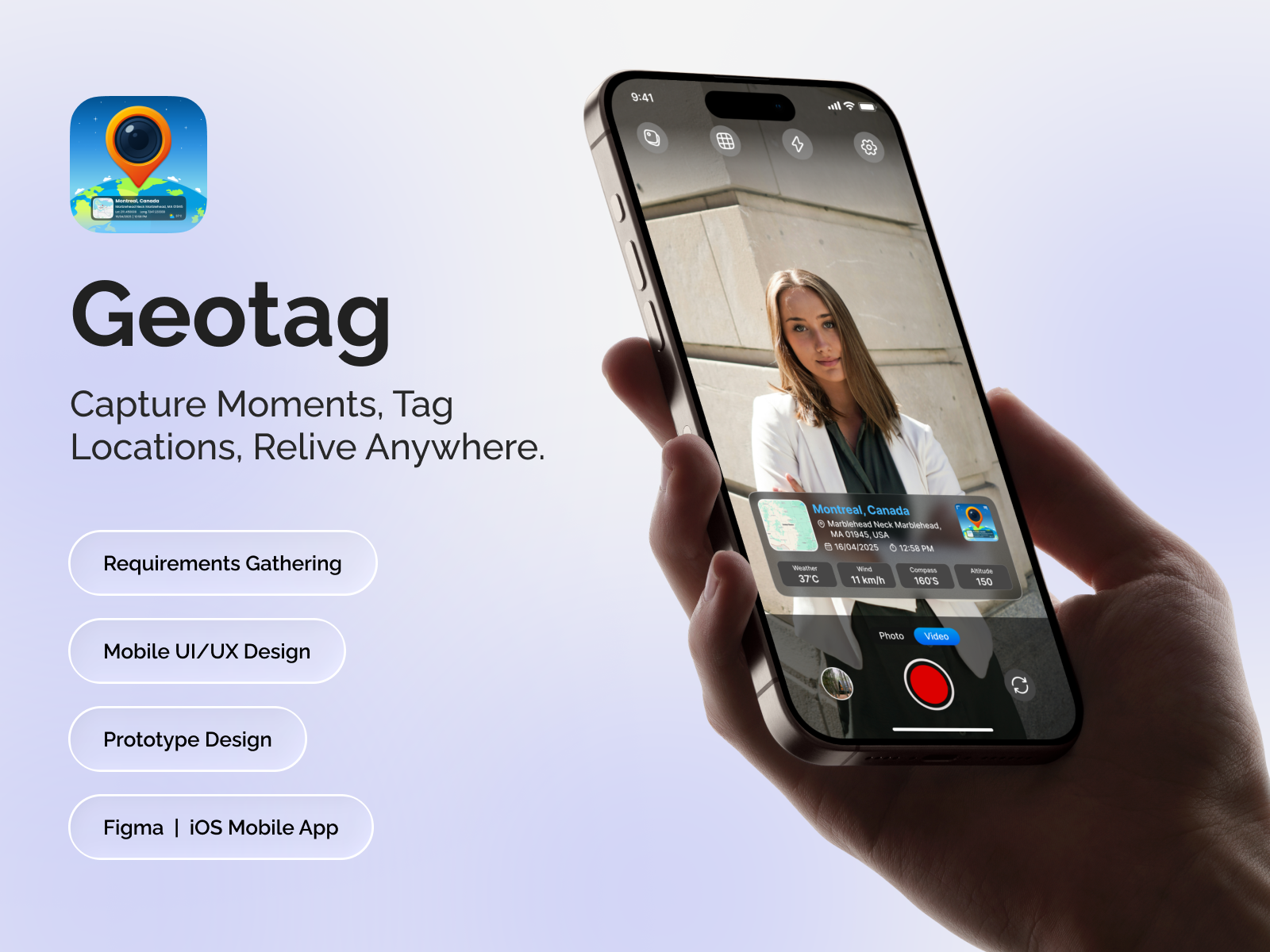
Geotag is a powerful iOS utility that merges high-definition photography with real-time geospatial data. Engineered for industries requiring verified visual proof - such as construction, banking, and field research - the app overlays precise coordinates, weather conditions, and timestamps directly onto media. It features an advanced folder-based management system and professional PDF reporting tools to transform raw captures into actionable documentation.
Core Features
-
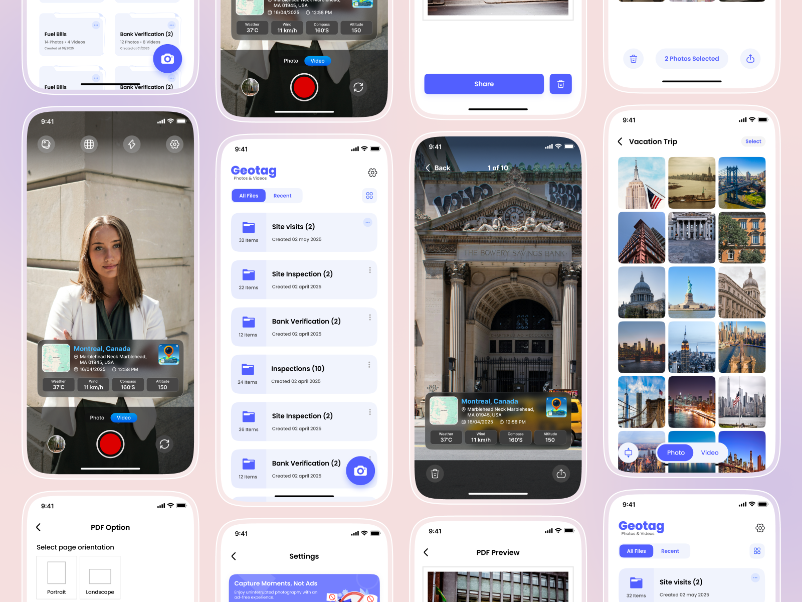
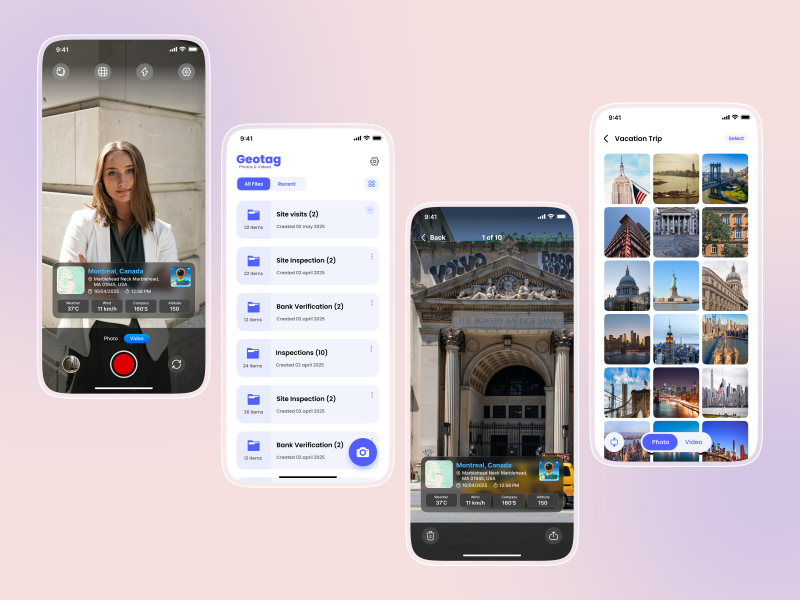
Dynamic Data Overlays: Real-time rendering of GPS coordinates, address, weather (temp/wind), compass heading, and altitude directly on the camera preview.
-
Smart Folder Categorization: Dedicated modules for "Site Visits," "Bank Verifications," and "Inspections" to keep professional assets organized.
-
High-Fidelity Media Capture: Toggle between Photo and Video modes with native iOS camera optimizations.
-
Professional PDF Reporting: Export captured media into branded PDF documents with orientation controls (Portrait/Landscape) for official submissions.
-
Geospatial Media Gallery: Integrated map view and grid gallery to relive moments or verify site data via spatial context.
-
Secure Cloud Sync & Export: Seamless sharing options and secure storage for sensitive inspection data.
Technical Stack
-
Frontend & UI/UX: SwiftUI and UIKit (Hybrid), Figma for high-fidelity prototyping and design flow.
-
Core Frameworks:
-
CoreLocation: For high-precision latitude/longitude tracking and geofencing.
- AVFoundation: For advanced camera controls, video processing, and custom overlays.
-
CoreMedia: For managing metadata timestamps and synchronization.
-
-
APIs & Integrations:
-
MapKit / Google Maps API: For real-time map rendering and coordinate picking.
-
OpenWeatherMap API: To fetch live environmental data (temperature, wind speed) based on GPS data.
-
CoreMotion: To drive the real-time compass and altitude sensor data.
-
-
Backend & Storage: Node.js REST API with MongoDB (as per your backend preference) for user profiles and cloud backups.
-
Reporting: PDFKit for native PDF generation and asset formatting.
Like what you see?
We can build something just as powerful for your business. Let's talk about your project.
Start a Conversation View App Development ServiceProject Gallery

Related Projects
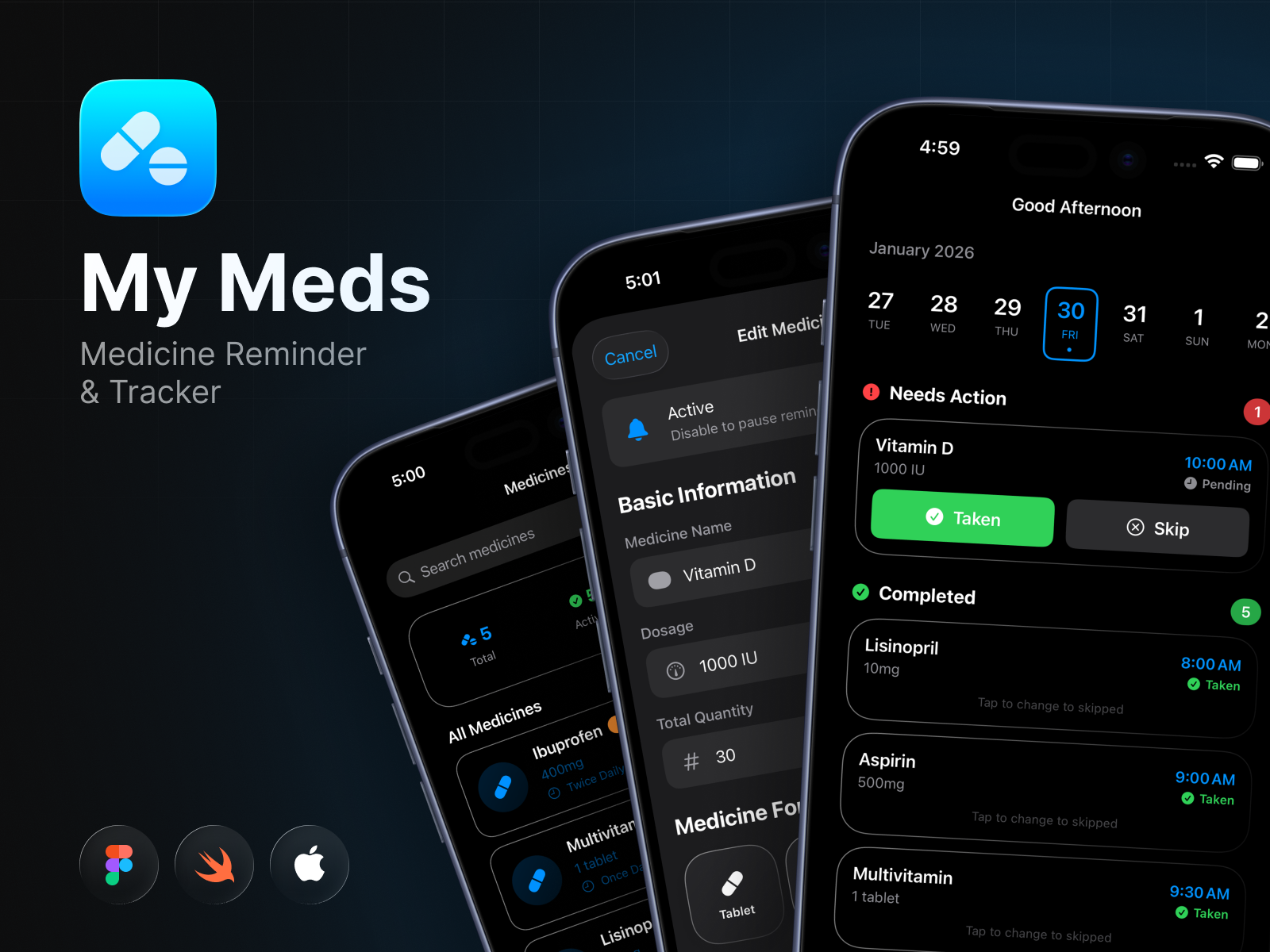
My Meds – Smart Medicine Reminder & Tracker
My Meds is a smart medicine reminder and tracking app built with SwiftUI that helps users manage doses, …
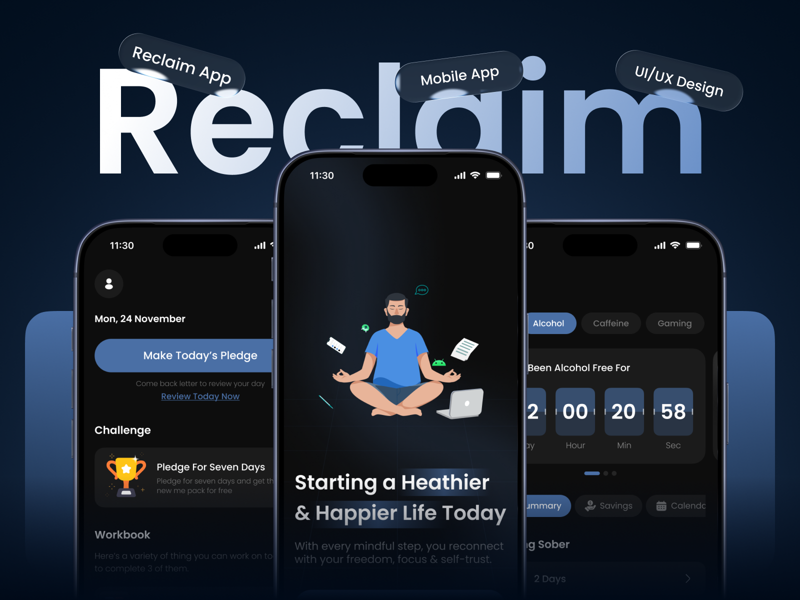
Reclaim – Habit Breaker & Addiction Recover App
Reclaim is a habit-breaking and addiction recovery tracker app that helps users monitor progress, track streaks, and stay …
Start a Project
Let's build something great together.
Tell us about your project and we'll put together a plan — no commitment required.
Send us a message
We'll get back to you within 24 hours.